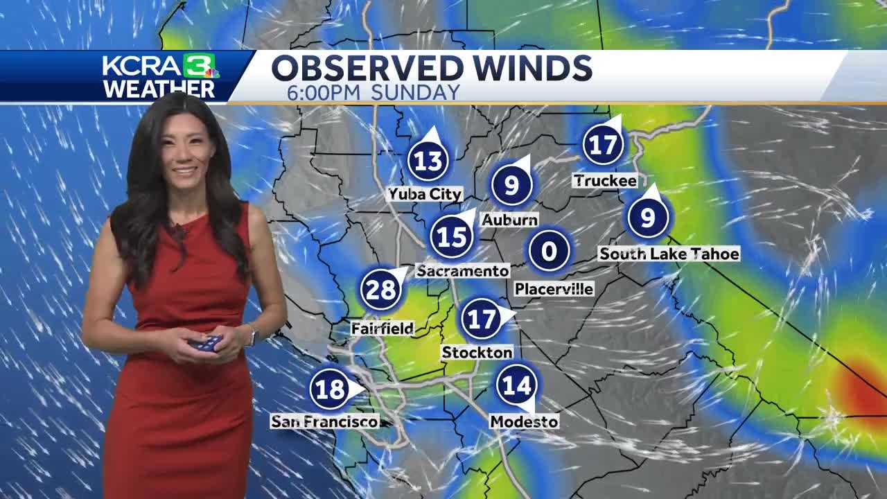
URGENT UPDATE: Northern California is set for a cool week as Delta breezes sweep through the region. Forecasts indicate that onshore winds will peak today, with gusts reaching between 10 to 20 mph. Afternoon highs will struggle to reach just 82°F in the valleys, while temperatures in the foothills will also linger in the low 80s, and the Sierra will see highs around 75°F.
A Lake Wind Advisory is currently in effect for the Sierra, where wind gusts could surge up to 35 mph, creating wave heights of up to 3 feet on local lakes. This advisory is expected to remain in place until Monday evening, posing potential hazards for boaters.
The unusual cooling is attributed to a cutoff low-pressure system that remains parked off the West Coast. While the winds will ease beginning Tuesday, temperatures are expected to stabilize in the mid-80s throughout the weekend. Residents should prepare for a consistent Delta breeze each afternoon, accompanied by passing clouds.
From Wednesday through Friday, the Sierra could experience a slight chance of storms, with the most significant activity anticipated on Thursday. Officials urge caution as conditions may change rapidly in the mountains.
Looking ahead, high pressure is projected to return next Sunday, which could push temperatures back into the 90s next week. This shift will mark a significant change from the current cool spell, making it essential for locals to remain informed on the evolving weather situation.
Stay tuned for further developments and take necessary precautions to ensure safety during these variable weather conditions.