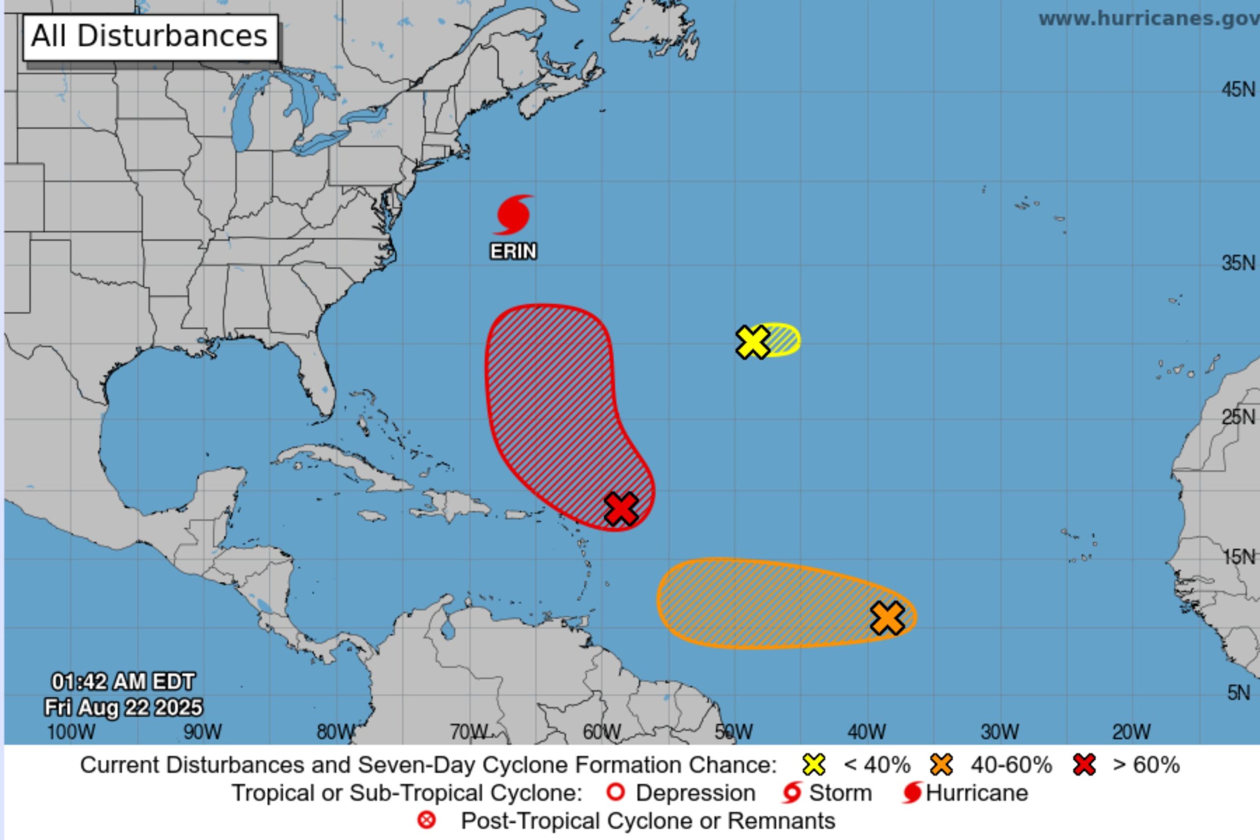
URGENT UPDATE: The National Hurricane Center (NHC) has just issued a tropical storm warning as three potential cyclones are forming in the Atlantic, posing a significant threat to the U.S. East Coast. The NHC confirmed that Tropical Storm Erin is already impacting beaches, while two other disturbances are under close watch.
As of Friday morning, the NHC reported a “small area of low pressure” located well southwest of the Azores. This system is struggling to develop, currently producing only occasional showers, and has a 10 percent chance of cyclone formation over the next 48 hours. However, forecasters indicate that “upper-level winds appear unfavorable,” leading to a decrease in development potential.
Despite the weak low likely to dissipate soon, authorities are closely monitoring two other systems. One disturbance carries a substantial 70 percent chance of becoming a cyclone within 48 hours. Another system has a 50 percent chance of development, raising alarms for coastal communities.
Meteorologist Chad Merrill from AccuWeather has indicated that the disturbance with the highest likelihood of formation not only aims to become a tropical storm but could escalate into a hurricane as it moves towards Bermuda this weekend into early next week.
The NHC continues to emphasize the urgency of these developments, urging residents along the U.S. East Coast to stay informed and prepared. With the potential for dangerous weather conditions, this is a critical time for local authorities and residents alike.
Stay tuned for ongoing updates as the situation unfolds. Authorities are advising all coastal residents to monitor the progress of these disturbances closely and heed any warnings issued in the coming days.