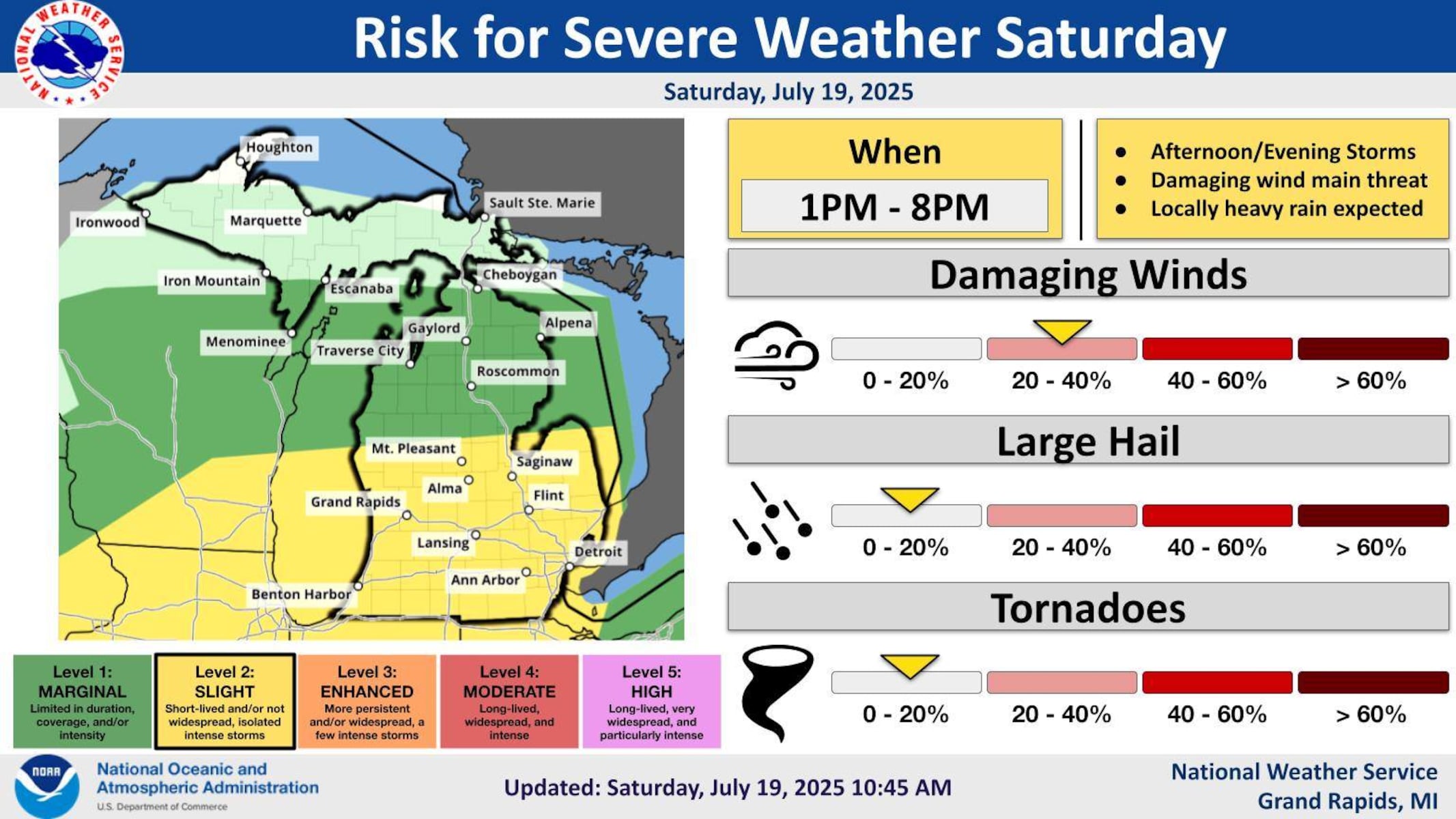
URGENT UPDATE: Severe storms are sweeping through Michigan today, bringing winds of up to 60 mph and the potential for significant damage. As of this afternoon, storms are already impacting the northern tip of the Lower Peninsula and the eastern Upper Peninsula (U.P.).
Meteorologists from the National Weather Service (NWS) confirm that a new wave of severe weather is moving across Lake Michigan, set to hit West Michigan shortly. The NWS warns that while the conditions are ripe for severe thunderstorms and heavy rain, predicting their exact formation remains uncertain.
The NWS forecasts a critical timeframe for storms between 1 p.m. and 8 p.m. today, particularly across southwest Lower Michigan. Residents are urged to prepare for damaging winds and localized flooding as storms develop. “Strong winds of 50 to 60 mph are the primary threat,” an NWS meteorologist in Grand Rapids stated. “Heavy rain could also lead to short-term flooding in low-lying areas.”
As the storms gather strength, the NWS notes that some regions may only experience brief showers, while others could face severe weather systems capable of causing substantial damage. “A threat for severe weather exists today,” the NWS added, emphasizing that the storms are expected to sweep from west to east across the state.
Residents are encouraged to monitor updated radar information on our dedicated weather page to stay informed about the latest developments. With the possibility of extreme weather looming, it’s essential to remain vigilant and prepared for sudden changes.
Stay tuned for further updates as this situation unfolds, and prioritize safety as these severe storms approach.