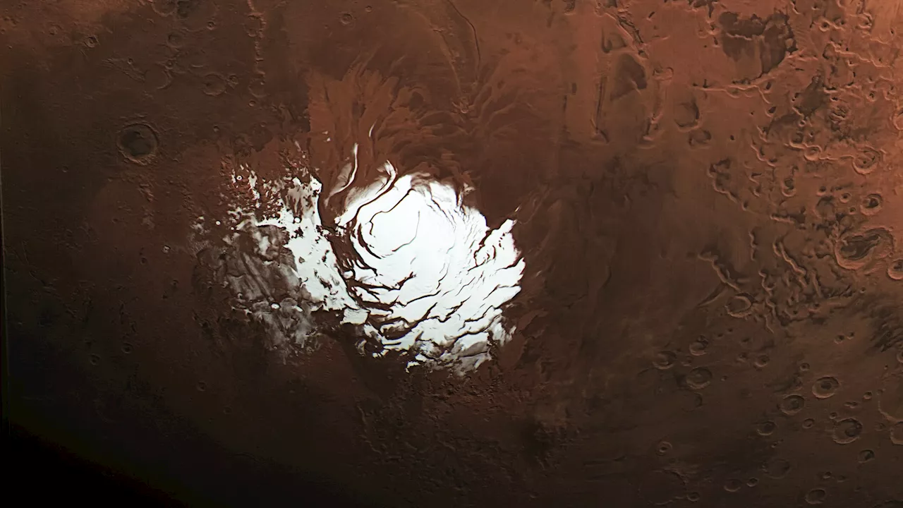
The NASA Mars Reconnaissance Orbiter (MRO) has provided new insights into a long-standing mystery at the Martian south pole. Using an innovative radar technique, scientists have concluded that a feature previously thought to be an underground lake is likely a layer of rock and dust. This revelation comes from data collected during a special maneuver on May 26, 2023, enhancing the orbiter’s ability to penetrate the Martian surface.
In 2018, the European Space Agency’s Mars Express detected a signal interpreted by scientists as evidence of a liquid water lake beneath the ice cap. This finding sparked considerable interest, as the presence of water is closely linked to the possibility of life beyond Earth. However, the latest results from MRO challenge this interpretation, suggesting that the same radar technology could be useful for identifying subsurface resources across Mars, which is crucial for future exploration.
The research, led by Gareth Morgan and Than Putzig from the Planetary Science Institute, utilized the Shallow Radar (SHARAD) instrument aboard MRO. By executing a precise 120-degree roll, the MRO was able to enhance radar signal sensitivity, allowing it to observe deeper layers of Martian geology than ever before. The innovation involved collaboration with the Jet Propulsion Laboratory (JPL) in California, which manages the MRO mission.
Morgan and Putzig have previously attempted to observe the area believed to host the buried lake without success. The 120-degree roll maneuver significantly improved the radar’s range, ultimately revealing a faint signal rather than the strong reflection expected from liquid water. This suggests that the bright signal detected by Mars Express might indicate a unique geological feature, rather than a body of water.
“We’ve been observing this area with SHARAD for almost 20 years without seeing anything from those depths,” Putzig noted. The faint signal detected by SHARAD, combined with a complete absence of signal from an adjacent region, raises questions about the nature of the Martian subsurface in this specific location.
The radar’s ability to differentiate between materials is critical in these observations, as various subsurface components can absorb or reflect signals differently. While liquid water typically produces a strong radar return, the data gathered suggests the presence of rock or dust instead. Morgan explained, “The lake hypothesis generated lots of creative work, which is exactly what exciting scientific discoveries are supposed to do. While this new data won’t settle the debate, it makes it very hard to support the idea of a liquid water lake.”
The south pole of Mars features an ice cap layered over heavily cratered terrain, creating a complex geological landscape. Radar images of the region have revealed numerous peaks and valleys, and it’s possible that the bright signal may simply represent an unusual smooth area, such as an ancient lava flow.
Researchers are eager to apply this advanced radar technique to other intriguing Martian regions, including Medusae Fossae, a vast geological formation located on the planet’s equator. This area has produced minimal radar returns, prompting scientists to speculate about its composition, which may include layers of volcanic ash or even deep-seated ice. Putzig emphasized the importance of this exploration for future human missions, as the equator is more conducive to sustaining human life due to increased sunlight and warmer temperatures.
NASA’s Jet Propulsion Laboratory oversees the MRO as part of the agency’s Mars Exploration Program, with operational support provided by Lockheed Martin Space in Denver. SHARAD was contributed to the MRO mission by the Italian Space Agency.
As MRO continues its exploration of Mars, the findings not only reshape our understanding of the Martian south pole but also pave the way for future missions seeking to uncover the planet’s hidden resources.