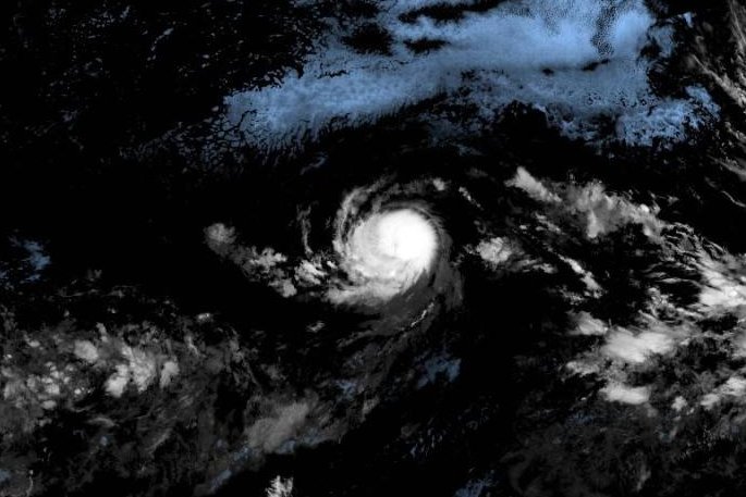
Tropical Storm Kiko has intensified into a Category 2 hurricane as of September 3, 2023. According to the National Hurricane Center (NHC), the storm recorded maximum sustained winds of 105 mph in its latest update at 5 p.m. HST. Currently, Kiko is positioned approximately 1,740 miles east of Hilo, Hawaii, and is moving westward at a speed of 7 mph.
Forecasts indicate that Kiko is likely to evolve into a major hurricane within the next couple of days. The NHC describes a subtropical ridge to the north of the storm as the primary steering feature, which is expected to guide Kiko’s movement. The forecast predicts a continued slow westward motion for the next few days, followed by a shift towards the west-northwest in approximately three to four days.
As of now, there are no weather watches or warnings in effect. The NHC anticipates that Kiko will remain over open waters in the Pacific Ocean, minimizing immediate threats to land. Despite the absence of direct hazards, the storm is expected to encounter drier air and cooler waters in the coming days. However, it may gain additional strength before this transition occurs.
Having formed on Sunday, Kiko marks the 11th named storm of the season in the Eastern North Pacific. The storm’s trajectory and potential developments will be closely monitored by meteorological agencies in the days ahead, highlighting the importance of preparedness in the event of significant shifts in its path or intensity.