Hurricane Humberto has escalated to a Category 4 storm as of September 15, 2023, according to the National Hurricane Center. The storm, which features maximum sustained winds of 145 mph, is expected to continue strengthening but will likely remain offshore, posing no immediate threat to the U.S. East Coast.
Forecasters indicated that Humberto’s predicted track will take it northwest before shifting to the north and northeast. This path places it between the U.S. East Coast and Bermuda. As of late Friday, no coastal watches or warnings were in effect.
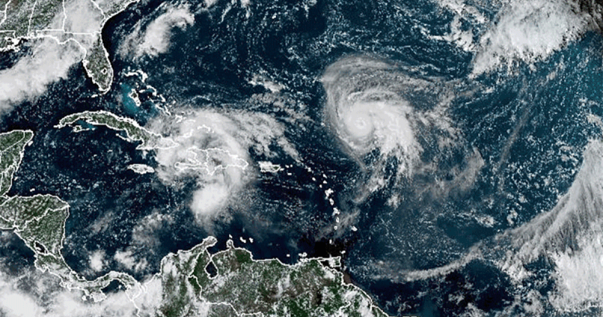
In addition to Humberto, meteorologists are monitoring a second disturbance known as Potential Tropical Cyclone 9. Situated northwest of Cuba, this system is anticipated to develop into a tropical storm over the weekend. The National Hurricane Center noted that it could reach hurricane intensity as it approaches the southeast U.S. coast early next week.
“The system is expected to be at or near hurricane intensity when it approaches the southeast U.S. coast, where there is a risk of storm surge and wind impacts,” the center stated in its forecast discussion. A tropical storm warning has been issued for the Central Bahamas, while parts of the northwest Bahamas are under a tropical storm watch.
As of Friday night, Potential Tropical Cyclone 9 has maximum sustained winds of 35 mph. A tropical storm is defined by sustained winds of 39 to 73 mph. This system is projected to bring significant rainfall, with forecasts suggesting up to one foot for eastern Cuba and between four to eight inches for the Bahamas.
The trajectory of Potential Tropical Cyclone 9 will likely take it along Florida’s Atlantic coast and towards South Carolina by Monday and Tuesday. The National Hurricane Center cautioned that after three days, there is considerable uncertainty regarding the storm’s path. Still, it appears the system may slow down considerably, potentially stalling near the South Carolina coast.
As weather conditions evolve, residents along the U.S. East Coast and in the Bahamas are advised to remain vigilant and stay updated on the latest forecasts from credible sources.