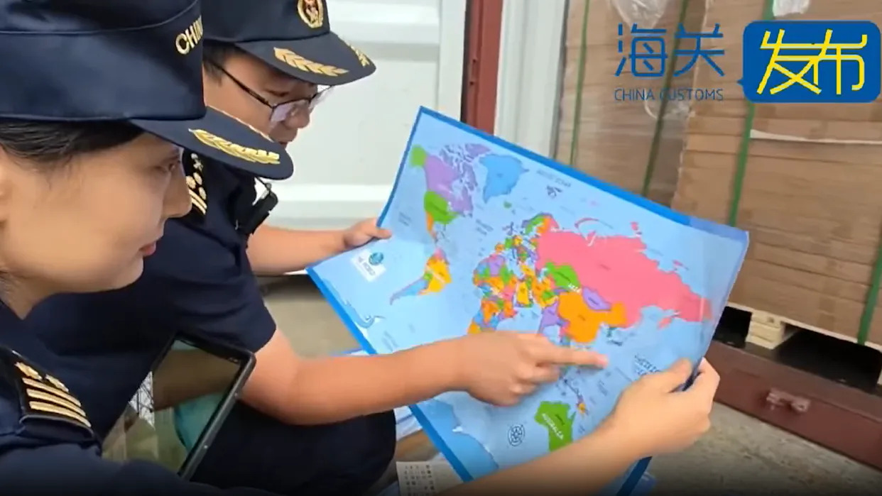
Chinese customs officials in Shandong Province have confiscated a staggering 60,000 maps that they claim mislabel the self-governed island of Taiwan. This action highlights ongoing tensions regarding territorial claims in the region, as Beijing regards Taiwan as a part of its territory. The authorities stated that these maps also “omitted important islands” in the South China Sea, a region marked by competing claims from China and its neighbors, including the Philippines and Vietnam.
According to the China Customs agency, the maps were intended for export but cannot be sold because they “endanger national unity, sovereignty, and territorial integrity.” The sensitive nature of map depictions in this context is evident, particularly concerning territorial disputes over various islands and reefs in the South China Sea. Notably, the confiscated maps did not include the nine-dash line, which China uses to assert its claim over nearly the entire South China Sea. This line extends hundreds of miles south and east from China’s southernmost province, Hainan.
The maps inaccurately labeled Taiwan as “Taiwan province,” although authorities did not specify the exact nature of the mislabeling. The Chinese government views Taiwan as a breakaway province and has not ruled out the use of force to assert control over the island. Conversely, Taiwan operates under its own constitution and has democratically elected leaders, viewing itself as distinct from the Chinese mainland.
Disputes in the South China Sea have recently intensified. Just over the weekend, a confrontation occurred between Chinese and Philippine vessels, leading to accusations from Manila that a Chinese ship deliberately rammed a Philippine government vessel. Beijing countered that the incident arose after the Philippine vessel ignored warnings and approached dangerously close.
Tensions regarding map portrayals are particularly acute for the Philippines and Vietnam. The controversy surrounding the 2023 film “Barbie,” which included a map depicting the nine-dash line, led to its ban in Vietnam and censorship in the Philippines. Such incidents underscore the sensitivity around territorial representations in cartography.
China Customs has not disclosed where the seized maps were destined for sale. The country is a major supplier of various goods globally, ranging from electronics to stationery. The recent confiscation of these maps is not an isolated incident; customs officers frequently seize maps deemed problematic. The scale of this latest seizure in Shandong, however, surpasses previous incidents.
In March, customs officials at an airport in Qingdao confiscated 143 nautical charts for containing significant errors regarding national borders. Earlier, in August, officers in Hebei Province seized two maps that included a misrepresentation of the border with Tibet.
The issue of map accuracy is pivotal in the broader context of regional relations and territorial integrity, as nations navigate complex historical claims and contemporary political realities.